This is the fourth camping trip we have made with our tent and, for the first time since we bought it we pack it up dry. It takes us about 2 hours to put everything away and pack it all in the car. The roof box is a boon as it means the car cabin is not full to the top and we can see out of the rear view mirror.
We stop for coffee in Launceston - once the capital of Cornwall - and for lunch at The Rose and Crown in East Lambrook. We are home again by 1430, unpack the car and head off to Sainsburys for supplies.
The Jubilee weekend beckons and we have two Sherborne schoolgirls staying for half term plus three grandchildren for some of the weekend.
Thursday, 31 May 2012
Wednesday, 30 May 2012
Week 3 Day 6 - Port Isaac to Padstow
This was another one of those days which starts overcast and misty in the morning and ends up sunny and warm in the afternoon.
We park at Port Isaac after a long drive via Wadebridge and Rock to check out the bus route for our return journey. The walk from Port Isaac to Port Quin is quite strenuous with several steep ups and downs with steps.

We have elevenses just after Port Quin and then it starts to rain very lightly but enough to put on waterproofs. The walk to Pentire Point is much less strenuous with gentle climbs and descents and the sun re-appears as we near the headland.

We have elevenses just after Port Quin and then it starts to rain very lightly but enough to put on waterproofs. The walk to Pentire Point is much less strenuous with gentle climbs and descents and the sun re-appears as we near the headland.
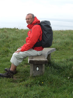
We have lunch on a stone bench overlooking the sea and are passed by a group of elderly bird watchers out looking for rare species with their long distance telescopes. On our way down to Polzeath we see a school of dolphins playing around a small fishing boat that is heading out to sea.
At Polzeath we walk across the beach and head on to Daymer Bay and Rock. We get to Rock at 1455, just missing the ferry to Padstow which leave as we walk up the slipway. No matter, the next one arrives 20 minutes later and we get to Padstow at about 1530. After a welcome cup of tea and slice of cake in a cafe right by the quay we head off to find the bus stop for buses to Wadebridge. On the way we buy a post card for Stuart & Lynne and an ice cream each. I almost lose mine as the ice cream falls out of the cone but I manage to catch most of it.
We catch the 1630 bus to Wadebridge, where we post the post card and take out some cash, followed by the 1725 to Port Isaac to retrieve the car. After a quick shower at the camp site and a change of clothes we celebrate the end of the week with a meal out (crab salad for Liz, ribeye steak for me) at the Port William pub we visited yesterday at Trebarwith Strand.
This has been quite a good week walking wise with plenty of good weather and very little rain. We have achieved our original objective and reached Padstow. We will be back in September to walk on to Newquay, Perranporth and, hopefully, St. Ives.
Distance completed today: 11.7 miles
Total distance completed: 166.8 miles (26.5%)
Distance completed today: 11.7 miles
Total distance completed: 166.8 miles (26.5%)
Tuesday, 29 May 2012
Week 3 Day 5 - Tintagel to Port Isaac
The day dawns misty and overcast but improves as the day goes on, eventually becoming a scorcher. I'm sat here feeling sore and wishing I had put sun cream on earlier.
We get up just after 0630 and, after a quick breakfast, park the car by the museum in Camelford (free parking) and catch the 0825 bus to Tintagel. Our bus passes aren't valid before 0930 so we have to pay £3 each. Walking down the main street in Tintagel towards the Coast Path, we bump into the couple we have met 3 times already. They are catching the bus to Port Isaac and walking back to Tintagel so we should expect to meet them just after half way.
The first part of the walk to Port Isaac is fairly easy, passing Tintagel Castle and the Tintagel Youth Hostel before descending steeply into Trebarwith Strand where we have a cup of coffee in The Port William pub. That is our last encounter with civilisation until we reach St. Geverne just before Port Isaac. We cross several deep valleys with steep sides, each one different and beautifully rugged in its own way. We count 5 such valleys which descend almost to sea level with ridges about 125m high in between. There are also 3 smaller valleys plus the valleys at Trebarwith and St Geverne.


Half way along the walk there are 4 deep valleys in quick succession. We stop for elevenses in the first by a pretty waterfall. We meet our "friends" again as we climb out of the second and stop for a chat. We meet and have a long chat with another couple from Minehead as we climb out of the third and we stop for lunch at the bottom of the fourth.
We are tired when we reach Port Isaac and are have a welcome cream tea in one of the many cafes in the town. We take a photograph of a friendly giant walking on the beach.

We catch the 1605 bus back to Camelford - our bus passes are OK this time - and buy supper in the local Co-op. I can't quite put my finger on it but Co-op stores all over the country never seem happy places like the big four supermarkets. If they could improve their image I'm sure more people would use them.

We catch the 1605 bus back to Camelford - our bus passes are OK this time - and buy supper in the local Co-op. I can't quite put my finger on it but Co-op stores all over the country never seem happy places like the big four supermarkets. If they could improve their image I'm sure more people would use them.
The guide book classifies today's walk as "severe" and there isn't another such day until we reach St. Ives, so the next weeks' walking should be dead easy - ha ha.
Distance completed today: 9.1 miles
Total distance completed: 155.1 miles (24.6%)
Monday, 28 May 2012
Week 3 Day 4 - Crackington Haven to Tintagel
After a peaceful night we rise at 0630 and, after breakfast, drive to Crackington Haven. We are parked and off walking by 0830 enjoying the spectacular scenery in this part of Cornwall. We meet two girls going in the opposite direction who camped out overnight. We meet very few other walkers all the way to Boscastle. On the way, we climb to the top of the highest cliff in Cornwall, imaginatively named High Cliff, at 233m and cross the spectacular valley at Pentargon with a waterfall taking the stream into the sea. Here we find dozens of orchids, some we haven't seen before, amongst the myriad wild flowers at the edge of the path.


We stop for lunch at the National Trust cafe in Boscastle. Surprisingly, they only offer pasties or sandwiches. Everything here is eaten with wooden knives and forks off paper plates. There are notices all around claiming how environmentally friendly this is, but Liz overhears someone asking where they are made - the surprising answer is "China"! Before we leave Boscastle, Liz encounters, for the third time, the couple who missed their connection at Hartland last Friday.
The walk from Boscastle to Tintagel is much busier with lots of people walking in both directions. The sun is shining and the sea is flat calm and a deep blue colour. You can see the bottom clearly.

Near Tintagel we encounter a group of more than 50 Czeck teenagers, with adult supervisors. We walk quickly in order to catch the 1545 bus back to Crackington Haven, which we manage with 20 minutes to spare.

Near Tintagel we encounter a group of more than 50 Czeck teenagers, with adult supervisors. We walk quickly in order to catch the 1545 bus back to Crackington Haven, which we manage with 20 minutes to spare.
At Crackington Haven we have tea and cake before taking the coast road back to Camelford via Tintagel.
Distance completed today: 11.4 miles
Total distance completed: 146.0 miles (23.2%)
Distance completed today: 11.4 miles
Total distance completed: 146.0 miles (23.2%)
Sunday, 27 May 2012
Week 3 Day 3 - Widemouth to Crackington Haven
After the hot weather of the last few days we wake in the night to a thunderstorm. It sounds as though the tent will be torn apart by the force of the rain. In the morning we discover that not a drop of water entered the tent - good old Outwell.
We eat a relaxed breakfast with boiled eggs and toast before heading off to Widemouth for today's short section to Crackington Haven. We park at 0930, pay £5.80 for 24 hours' parking and head south under low cloud and occasional mist.
We cross the valley at Millook and along past Dizzard Point where we come across a bench stating 500 miles to go to Poole, 132 miles completed from Minehead.

By now it has started to rain, not heavily but it is persistent. Soon after we cross a deep steep-sided valley and are overtaken by a single walker on his way from Minehead to Poole camping as he goes. He is into Day 9 of his trek, we are on Day 13 of ours!
We cross the valley at Millook and along past Dizzard Point where we come across a bench stating 500 miles to go to Poole, 132 miles completed from Minehead.


By now it has started to rain, not heavily but it is persistent. Soon after we cross a deep steep-sided valley and are overtaken by a single walker on his way from Minehead to Poole camping as he goes. He is into Day 9 of his trek, we are on Day 13 of ours!
The deep valley at Cleave between Castle Point and Pencannow Point is spectacular in its isolation. It lacks any development and is covered in a myriad of wild flowers, including some wild miniature roses that have obviously bloomed in the recent good weather.
We reach Crackington Haven as the rain stops and the warm sun starts to shine. We stop in The Haven Cafe for a welcome pasty and a drink before catching the bus back to Widemouth and back to camp (via Sainsburys in Bude) to read the Sunday paper and to relax for the remains of the day.
Distance completed today: 7.2 miles
Total distance completed: 134.6 miles (21.4%)
Distance completed today: 7.2 miles
Total distance completed: 134.6 miles (21.4%)
Saturday, 26 May 2012
Week 3 Day 2 - Morwenstow to Widemouth
Another gloriously sunny day but with a strong, at times gale force, wind blowing from the east. We leave the camp site at 0820, park up in Bude (£5 for the day) and catch the 0918 bus to Morwenstowe. Whilst waiting for the bus we get chatting to another guy in the bus shelter who, we discover, lives in Yeovil and is visiting his mother in Bude. He is a retired English teacher called Robin who did some youth work in the town and knows Pete Brier, the retired youth workers from Tinneys Lane in Sherborne. He is off by bus to visit his grand-daughter in Truro.
We are the only passengers on the bus out to Morwenstowe and arrive c0945 and walk out to join the coast path where we left it yesterday afternoon. We have several steep valleys to cross although they get successively lower in height as we get nearer to Bude. The strong wind is welcome as it keeps us cooler but tends to blow my hat off at every opportunity so my bald patch is exposed to to the sun!
We stop for elevenses at Duckpool where there are obviously people who have camped out overnight.

We discover a cafe at Sandy Mouth and have coffee and a toasted tea cake. Liz suggests we walk on to Widemouth after Bude to get some of tomorrow's walk under our belts in advance. We get to Bude c1330 and stop for lunch on the beach where the tide had gone right out and there are many families out enjoying the fine weather. The wind is still blowing hard and from time to time we get blasted with sand as we walk back to the car.

We discover a cafe at Sandy Mouth and have coffee and a toasted tea cake. Liz suggests we walk on to Widemouth after Bude to get some of tomorrow's walk under our belts in advance. We get to Bude c1330 and stop for lunch on the beach where the tide had gone right out and there are many families out enjoying the fine weather. The wind is still blowing hard and from time to time we get blasted with sand as we walk back to the car.
After an ice cream we set off along the cliff path to Widemouth. This is a much busier section of the coast path and we meet many people going in the opposite direction. We get to Widemouth at 1515 and miss the 1520 back to Bude whilst studying the timetable by the bus stop on the opposite side of the road! We have a drink in the beach cafe and wait to catch the 1621 coming from Crackington Haven. The bus eventually turns up 20 minutes late just as we are about to give up and start walking back to Bude. Also on the bus are the couple who missed their connection at Hartland yesterday.
We visit Sainsburys on the way home and have a pleasant evening in the sunshine reading the paper and doing the puzzles.
We visit Sainsburys on the way home and have a pleasant evening in the sunshine reading the paper and doing the puzzles.
Distance walked today on the GPS was 0.61 from Morwenstowe to the coast, 7.5 miles along the coast path to Bude and another 3 miles to Widemouth making 11.1 miles in all.
Distance completed today: 10.65 miles
Total distance completed: 127.4 miles (20.2%)
Distance completed today: 10.65 miles
Total distance completed: 127.4 miles (20.2%)
Friday, 25 May 2012
Week 3 Day 1 - Hartland Quay to Morwenstow
We are up and about early, before anyone else, at 0630 so that we can be off to Hartland Quay as soon as possible. We are hoping to walk all the way to Bude - 15 strenuous miles according to the guidebook. We get away by 0745 and park up in Hartland Quay at around 0845.
We are the first to park in the upper car park and set off in glorious sunshine along the coast.

The first 4 miles are not too bad - a gentle climb up to 150m and then a fairly flat plateau thereafter. The waterfall at Speke's Mouth is spectacular. At about 5 miles, the going gets tough with several steep-sided valleys to cross, each 150m deep, and the sun beating down relentlessly. We both get tired and dehydrated even though we have brought plenty of water.

The first 4 miles are not too bad - a gentle climb up to 150m and then a fairly flat plateau thereafter. The waterfall at Speke's Mouth is spectacular. At about 5 miles, the going gets tough with several steep-sided valleys to cross, each 150m deep, and the sun beating down relentlessly. We both get tired and dehydrated even though we have brought plenty of water.
We stop for lunch at Welcombe Mouth and talk to a National Trust warden who is putting up notices to say that the car park is closed overnight - it is hoped that this will deter campers and revellers who have caused some vandalism recently, including setting fire to a large patch of gorse on the hillside. They are also worrying about some rare wildlife that they have in the area - particularly a creature called an 'oil beetle' which is apparently parasitic on lone bees.
At Marsland Mouth we leave Devon and cross into Cornwall.


Because of the oppresive heat and our obvious tiredness and slow progress, we decide to stop at Morwenstow and leave the stretch to Bude for tomorrow. We have a refreshing pot of tea in The Rectory tea rooms followed by a pint of ale in The Bush. We catch the 1621 bus to Bude followed by the 1730 from Bude to Hartland. One unfortunate couple on the same bus are hoping to catch the connecting service from Hartland to Clovelly but we are late and can just see the back of the Bideford bus disappearing as we drive into Hartland. We learn later that they have to take a taxi.
We have a 3 mile hike from Hartland to Hartland Quay back to the car and we have an evening meal in the hotel. We stop at Morrisons in Bude for some shopping for tomorrow and get back to Camelford after sunset at around 2130. After a quick shower and brush up we turn in for an early night.
We have a 3 mile hike from Hartland to Hartland Quay back to the car and we have an evening meal in the hotel. We stop at Morrisons in Bude for some shopping for tomorrow and get back to Camelford after sunset at around 2130. After a quick shower and brush up we turn in for an early night.
Distance walked today 7.75 miles on the coast path plus another 0.6 miles into Morwenstow.
Total distance completed: 116.75 miles (18.5%).
Total distance completed: 116.75 miles (18.5%).
Thursday, 24 May 2012
Week 3 Day 0 - Sherborne to Camelford
We are off on week three of the great south-west coast trek. We have booked camping at Joliot's Well in Camelford. Having packed the tent and all the camping gear on Tuesday afternoon, we only have to sort out our clothes for the week and any food that we are taking from home.
With the sun beating down from an azure sky, we leave Sherborne c0930 and head west, stopping for coffee in Honiton, and continuing on to Boscastle where we have lunch - nothing special - in a pub just by the car park. Some sea mist is covering the coastal strip down in these parts so we don't hang around and set off to find our camp site. The charge for the week is £133 which is a bit steep. The camp site is mostly static vans and cabins with a few hard standings for caravans and tourers and a couple of sites where tents will go. All pitches have access to electricity but we are not geared up for it.
We get quite sweaty putting up the tent in the full afternoon sun but enjoy a pleasant beer afterwards. The showers are different to anything we have encountered before. It is a set of rooms each with a WC, basin and shower cubicle plus soap and hand drier. Men and women use the same showers. There is a hair drier and one room has a bath for which you have to pay extra.
We drive down to Tescos in Wadebridge (sorry Martin) to stock up with supplies for breakfast and packed lunches. After a late night shower in the unisex shower block we turn in for an early night.
Friday, 4 May 2012
Week 2 Day 9 - Home again
After breakfast we pack our bags and are out of the cottage by 0830. We are back in Sherborne for coffee by 11am. A reasonably successful week despite the bad weather and the mud. We shall be back again, weather permitting, under canvas this time, on 24th May for another week.
Thursday, 3 May 2012
Week 2 Day 8 - Rain again
The rain has been falling all night and is still falling at breakfast so we decide not to attempt today's testing walk. We had planned to walk from Hartland Quay to Bude - the hardest section in the itinerary with nearly 5000 feet of ascent and descent crossing ten valleys. It would have been muddy as well.
Instead we head off to the RHS gardens at Rosemoor after breakfast and have an interesting stroll around the gardens under our umbrella. There are lots of well-behaved, well-supervised primary school children wandering around seemingly oblivious to the rain.


Instead we head off to the RHS gardens at Rosemoor after breakfast and have an interesting stroll around the gardens under our umbrella. There are lots of well-behaved, well-supervised primary school children wandering around seemingly oblivious to the rain.


We have an excellent lunch at The Bush Inn, Morwenstow - recommended in The Good Pub Guide - where we end up in conversation with a retired couple living locally who have moved down from Solihull with their dogs.
After lunch we visit Bude and pick up the Cornwall Bus Timetable so that we can work out a detailed plan for the next stage in a month's time.
Wednesday, 2 May 2012
Week 2 Day 7 - Clovelly to Hartland Quay
A beautiful day with unbroken sunshine from start to finish.
We park at the Clovelly Visitor Centre at 0855, put on our walking gear and, because the centre is still closed, we walk round the side and off along the coast path without having to pay for car parking.
There are a couple of steep-sided valleys to negotiate, and in one case we have to cross the stream by stepping stones. Unfortunately, the stream is still in spate and the stepping stones are a couple of feet under water so we walk down the beach and cross where the stream has fanned out and become much shallower.
We are overtaken by a chap whom we met yesterday walking on his own. Yesterday he had his wife and dog with him but not today. He tells us that the dog is getting old and couldn't cope with another walk like yesterday's so his wife is staying with the dog and waiting to meet him at Hartland Point. Later we meet all three at Hartland Point having lunch.
Just after meeting our lone walker we have to walk down a steep path in a field containing a horse. The path is extremely muddy and, to make matters worse, I am sure the horse uses the path for its toilet. Our boots are wet and very muddy by the time we cross the bridge at the bottom. However, on the whole the mud is much less than yesterday and we stay relatively clean.
At Hartland Point we have a cup of tea at the cafe by the car park and then have our lunch in a field just past the lighthouse. We are joined by a couple of French women who tell us they are doing a circular walk from Hartland Quay.
The geology from Hartland Point to Hartland Quay is fascinating with heavy folding and faulting of the sandstones and mudstones. There is also what looks like the remnants of a river valley that has been eroded at both ends by the sea.

At Hartland Quay we have a drink and take some photos before heading inland to the village of Hartland to catch the bus back to Clovelly. We walk up the hill past the impressive church at Stoke with its massive tower. Then we divert back across the Abbey Stream, past the impressive Hartland Abbey and walk across some fields where we encounter sheep before descending again and following the stream through some woodland. Finally, we cross the stream and climb up into Hartland village via what looks like an ancient track that is also very muddy.
We enter the village by the National Geological Survey's Magnetic Monitoring Station and wait for about an hour before the bus arrives. We are joined by a German couple - mother and daughter it seems - who also catch the bus but don't speak much English.
Distance completed today: 10.3 miles
Total distance completed: 109.0 miles (17.3%)
Tuesday, 1 May 2012
Week 2 Day 6 - Westward Ho! to Clovelly
Mud, mud, glorious mud. And today we had lots of it. It was so bad we both slipped over in it.
Today's walk, from Westward Ho! to Clovelly was described as "strenuous" in the guide book and it most certainly was. Apart from about a mile at the start and the last 2 miles at the end we were either climbing up or sliding down steep sided valleys.
We park the car at Bideford and get the bus to Westward Ho! I have forgotten my bus pass and have to pay full price for the journey. At Westward Ho! we set off along the old railway track which once ran from Westward Ho! to Bideford. When that turns inland we continue along the coast path. In many places it is possible to pick our way around the mud but not always and our boots and gaiters soon become wet and covered in a layer of oozing mud. After that we don't try too hard to avoid the mud and often walk straight through it.
The sun soon appears and it starts to get quite warm. We soon dispense with our waterproofs. We stop for coffee on a bench with a glorious view of the bay as far as Saunton with Lundy to the left. At one point we have to walk along the beach for about 50 yards and there is a stream flowing into a large pool which is dammed by the beach and draining through the shingle out to sea. Liz bravely walks across the top of the dam, I worry that the dam might give way and cross the beach lower down well away from the dam!
Continuing onwards, the underlying rock turns to the familiar red Devonian sandstone and the mud becomes particularly slippery. We both take tumbles. I manage to avoid falling over completely by grasping a nearby tree but poor Liz ends up with mud on her knees and, soon afterwards, on her backside.
We reach Peppercombe where we say hello to some National Trust foresters. We miss the sign showing us the coast path and end up on the beach. We decide to stay and eat our lunch before climbing back up the cliffs.
We meet 6 people walking in the opposite direction - the first walkers we have met so far. One couple had caught the bus and are walking back to Abbotsham where they are staying.
We cross another steep-sided valley at Bucks Mill and carry on through the mud, eventually coming out near the end of The Hobby - a track along the cliffs built at the end of the Victorian period by two local worthies, Frederick and Christine Hamlyn. This brings us out by the Clovelly Visitor Centre some 7 hours after we set off from Westward Ho!
Despite our muddy and disheveled appearance we are able to get a cup of tea and a piece of cake and to visit the local shop. We have to hang around for another hour for the bus back to Bideford which leaves at 1828 and we don't arrive back at Cobb Cottage until well after 8 pm.
Distance completed today: 11.2 miles
Total distance completed: 98.7 miles (15.7%)
Today's walk, from Westward Ho! to Clovelly was described as "strenuous" in the guide book and it most certainly was. Apart from about a mile at the start and the last 2 miles at the end we were either climbing up or sliding down steep sided valleys.
We park the car at Bideford and get the bus to Westward Ho! I have forgotten my bus pass and have to pay full price for the journey. At Westward Ho! we set off along the old railway track which once ran from Westward Ho! to Bideford. When that turns inland we continue along the coast path. In many places it is possible to pick our way around the mud but not always and our boots and gaiters soon become wet and covered in a layer of oozing mud. After that we don't try too hard to avoid the mud and often walk straight through it.
The sun soon appears and it starts to get quite warm. We soon dispense with our waterproofs. We stop for coffee on a bench with a glorious view of the bay as far as Saunton with Lundy to the left. At one point we have to walk along the beach for about 50 yards and there is a stream flowing into a large pool which is dammed by the beach and draining through the shingle out to sea. Liz bravely walks across the top of the dam, I worry that the dam might give way and cross the beach lower down well away from the dam!

Continuing onwards, the underlying rock turns to the familiar red Devonian sandstone and the mud becomes particularly slippery. We both take tumbles. I manage to avoid falling over completely by grasping a nearby tree but poor Liz ends up with mud on her knees and, soon afterwards, on her backside.
We reach Peppercombe where we say hello to some National Trust foresters. We miss the sign showing us the coast path and end up on the beach. We decide to stay and eat our lunch before climbing back up the cliffs.
We meet 6 people walking in the opposite direction - the first walkers we have met so far. One couple had caught the bus and are walking back to Abbotsham where they are staying.
We cross another steep-sided valley at Bucks Mill and carry on through the mud, eventually coming out near the end of The Hobby - a track along the cliffs built at the end of the Victorian period by two local worthies, Frederick and Christine Hamlyn. This brings us out by the Clovelly Visitor Centre some 7 hours after we set off from Westward Ho!
Despite our muddy and disheveled appearance we are able to get a cup of tea and a piece of cake and to visit the local shop. We have to hang around for another hour for the bus back to Bideford which leaves at 1828 and we don't arrive back at Cobb Cottage until well after 8 pm.
Distance completed today: 11.2 miles
Total distance completed: 98.7 miles (15.7%)
Monday, 30 April 2012
Week 2 Day 4 - Bideford to Westward Ho!
We decide to tackle the walk from Bideford to Westward Ho! despite the threat of rain in the air. We park on the quay in Bideford and, wearing full waterproof gear, head north towards Appledore starting at 0940. The path is interesting if somewhat muddy. It passes through housing developments, woodlands, fields, beach and cliff. Due to the heavy rain yesterday, there are frequent puddles and many that it is impossible to walk around.
By 1040 we have reached Appledore and stop for coffee and a toasted teacake in The Quay cafe - a very welcoming place with excellent service and good value. As it has stopped raining we remove our waterproof trousers and pack them in Liz's rucksack. Just as we leave it starts to rain again but only briefly.
We walk around the coast to Westward Ho! passing within half a mile of where we were on Friday last - 3 days ago! - across the estuary. The wind is relentless and cold (from the south east) and a few short rain showers keep us damp. At one point my hat blows off my head straight into a large puddle of water left over from yesterday's downpour.

As we walk around the sand dunes at Northam Burrows, there are a few hardy golfers out on the golf course braving the strong wind and occasional rain. We reach Westward Ho! at about 1300 after a walk of nearly 8 miles and sit on a bench on the sea front to eat our packed lunch. Afterwards, we walk into town seeking a hot cup of coffee and find the 1325 bus about to leave for Bideford. We decide to take it, leave our walking togs in the car and head into Bideford town centre for coffee.
Distance completed today: 9.3 miles
Total distance completed: 87.5 miles (13.9%)
Week 2 Day 3 - Rain
We awake to the sound of rain on the roof light in the bedroom and get up late to a cooked breakfast. We decide to cancel our plans to walk today and head off to Atlantic Village to have coffee, buy a newspaper and do some shopping.
As the rain pounds down we go to The Thatched Inn at Abbotsham for lunch - roast beef with far too much to eat - washed down with a pint of Doom Bar. After a short tour of Westward Ho! and Appledore we return to Cobb Cottage and relax for the afternoon and evening.

We had hoped to watch an episode or two of The Killing but discover that the box we had brought from home contains no disks - then I remember I had removed them and put them in the DVD folder Toby gave me last Christmas. You have to laugh, don't you?
Sunday, 29 April 2012
Week 2 Day 2 - Braunton to Bideford
We rise early, before 7am, have a quick breakfast of cereal, make our packed lunch and head off towards Bideford at 0755. Having parked in the long term car park on the quayside we head off to catch the bus to Barnstaple only to see the 0815 bus drive off just as we get there! Liz notices another bus displaying Barnstaple as its destination on the other side of the road (facing the other way!) so we rush over and get on board. We discover it has come from Exeter (service 315) and takes the direct route over the bridge avoiding all the villages. We arrive at Barnstaple Bus Station at 0840 (some 15 minutes ahead of the bus we missed) and just manage to flag down a bus leaving for Braunton. This means that we are up and running by 0900.
The walk to Barnstaple is along the Tarka Trail, a disused railway line on the north shore of the estuary. It is very flat, tarmac all the way and, after we leave Chivenor is pretty boring. We complete the 5 miles to Barnstaple by 1030 and stop for coffee in The Old Bus Station Cafe. On the way we watch some guys - some looking older than us - launching a couple of 6-man gigs into the river and going off for a row.

After coffee we visit the Tourist Information Centre, purchase a new map covering the later sections of this week's walking and head off along the Tarka Trail towards Bideford. This time we are walking in the opposite direction about half a mile south of where we walked before coffee. The trek to Instow is pretty unremarkable. Flat and straight on tarmac all the way. The only excitement is when cyclists come tearing past with no warning. They are so quiet we can't hear them coming unless they shout or the ring their bell - and several don't bother!
Just before Instow we stop for lunch in a picnic site with wooden tables and benches. There is also a mud hut with seats built into the wall but we prefer to sit out in the open air. We get quite cold and head into Instow for a hot coffee in the local sea-front pub.
The walk from Instow to Bideford is still quite flat but far more interesting than before as the scenery is constantly changing and there appear to be a lot more people out for a stroll or a ride on their bike. We get to East-the-Water, cross the old Bideford Bridge and head back to the car. We arrive back at half past three (six and a half hours from Braunton) having completed 15.5 miles.
We dump our rucksacks, change our boots and head off into town to have a cup of tea and do a little shopping. We call in at Morrisons to buy some more provisions on the way back to Cobb Cottage.
Distance completed today: 15.4 miles
Total distance completed: 78.2 miles (12.4%)
Saturday, 28 April 2012
Week 2 Day 1 - Croyde Bay to Braunton
We get up at 0640 intending to make an early start from Sherborne so that we can walk from Croyde Bay to Braunton before checking in to our cottage in the village of Littleham just west of Bideford. We manage to clear up breakfast, get everything packed in the car and away by 0855.
We stop for coffee at 11am in South Molton. One of the best toasted teacakes I have had for a long time. Best of all they put lashings of butter on for you whilst the teacake is piping hot so that it all melts and soaks into the cake. It rains briefly whilst we are there, but undeterred we press on through Barnstaple and park in the centre of Braunton.
We catch the 1215 bus to Croyde Bay (where we got to last September) and set off across the beach as the sun starts to appear. Lundy is bathed in sunshine and clear as a bell in the distance. The sea is relatively calm and there are a few keen surfers trying to make something of the piddling little waves.
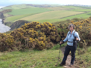
We walk along the cliffs round towards Saunton and stop for lunch on a bench overlooking the sea. Soon the path crosses the coast road and we have to walk through gorse for about a mile. The gorse is in bloom and looks lovely but there are thousands of insects flying around in the warm April sunshine.
At Saunton we descend to the beach by the 4-star Saunton Sands Hotel and decide to walk along the beach rather than follow the official route through the sand dunes. The beach is 3.5 miles in extent and the tide is out so we have a lovely walk in the sunshine. We are surprised at one point as two young girls come galloping up behind us on horseback and startle both of us! Otherwise the beach is relatively deserted and we have the place to ourselves for most of the way.

At the southern end of the beach, with the village of Appledore seemingly within touching distance, we turn inland across the dunes to the White House and follow the path along the estuary for 3 miles up to Braunton.
We reach the car at approximately 1630, after walking 10.5 miles, and decide to move on as the parking ticket is close to expiry. We call in at the local Tesco superstore to get some provisions and head off to find our accommodation for the week - Cobb Cottage.
After a pleasant supper we tuck in for an early night as we want to start early tomorrow.
Distance completed today: 8.8 miles
Total distance completed: 62.8 miles (10.0%)
We stop for coffee at 11am in South Molton. One of the best toasted teacakes I have had for a long time. Best of all they put lashings of butter on for you whilst the teacake is piping hot so that it all melts and soaks into the cake. It rains briefly whilst we are there, but undeterred we press on through Barnstaple and park in the centre of Braunton.
We catch the 1215 bus to Croyde Bay (where we got to last September) and set off across the beach as the sun starts to appear. Lundy is bathed in sunshine and clear as a bell in the distance. The sea is relatively calm and there are a few keen surfers trying to make something of the piddling little waves.
We walk along the cliffs round towards Saunton and stop for lunch on a bench overlooking the sea. Soon the path crosses the coast road and we have to walk through gorse for about a mile. The gorse is in bloom and looks lovely but there are thousands of insects flying around in the warm April sunshine.
At Saunton we descend to the beach by the 4-star Saunton Sands Hotel and decide to walk along the beach rather than follow the official route through the sand dunes. The beach is 3.5 miles in extent and the tide is out so we have a lovely walk in the sunshine. We are surprised at one point as two young girls come galloping up behind us on horseback and startle both of us! Otherwise the beach is relatively deserted and we have the place to ourselves for most of the way.

At the southern end of the beach, with the village of Appledore seemingly within touching distance, we turn inland across the dunes to the White House and follow the path along the estuary for 3 miles up to Braunton.
We reach the car at approximately 1630, after walking 10.5 miles, and decide to move on as the parking ticket is close to expiry. We call in at the local Tesco superstore to get some provisions and head off to find our accommodation for the week - Cobb Cottage.
After a pleasant supper we tuck in for an early night as we want to start early tomorrow.
Distance completed today: 8.8 miles
Total distance completed: 62.8 miles (10.0%)
Subscribe to:
Comments (Atom)